Advertisement
Advertisement
Advertisement
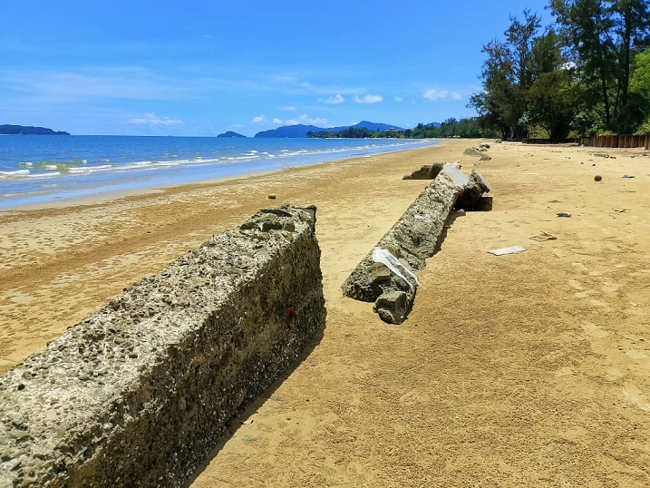 DID Malaysia, with co-ordination from DID Sabah, has carried out three feasibility study projects by consultant for three areas namely Tinagat-Batu Puyong near Tawau, Tungku near Lahad Datu and Tanjong Aru-Kinarut coastal zone near Kota Kinabalu which are classified as Catergory 1 in Sabah.
DID Sabah is also working closely with other government departments/agencies involved in coastal zone management.
Meanwhile, Malaysian Association of Environmental Health Secretary Rudiaswady Abdul Rahim in January 2024 raised concerns over the ongoing coastal erosion affecting Malaysia, particularly in Sabah and Sarawak.
Overall, Malaysia’s 8,840km coastline faces significant challenges, with 1,347.6km affected by erosion and 431.3km classified as critical and significant.
Given that the data originates from 2015, Rudiaswady highlighted the urgent need for updated assessments. “We lack insights into the current state of coastal erosion.
But one thing is certain, it is deeply concerning that we may be losing our beautiful beaches,” he warned.
He urged the Government to conduct a comprehensive survey on coastal erosion and implement a holistic strategy incorporating nature-based solutions, hybrid strategies, early warning systems and investments in nature-based infrastructure to mitigate further damage.
Jellyfish blooms linked to climate change
CLIMATE change has altered the distribution patterns of sea turtles in Sabah, primarily due to rising sea temperatures, shifting ocean currents and habitat loss.
Dr Madihah said recent observations in Sabah suggest possible shifts in hawksbill turtle nesting sites.
“For many years, hawksbills have primarily nested on Pulau Gulisaan in Turtle Islands Park (Sulu Sea). However, a hawksbill turtle with flipper tags from Turtle Islands Park was recently recorded nesting in Semporna (Celebes Sea). This raises important questions about whether some turtles are beginning to explore alternative nesting beaches.
“This may be linked to habitat degradation, as severe erosion has impacted the main hawksbill nesting site in Turtle Islands Park, potentially forcing turtles to seek new nesting grounds,” she said.
On a global scale, she said shifting nesting sites have already been documented as a response to climate change. Warmer temperatures are pushing certain species, such as leatherbacks, further north, and some nesting seasons are expanding.
While extensive long-term monitoring is needed to confirm similar trends in Sabah, these local and global shifts highlight the need for conservation strategies to protect potential new nesting areas and enhance resilience against climate-driven habitat changes.
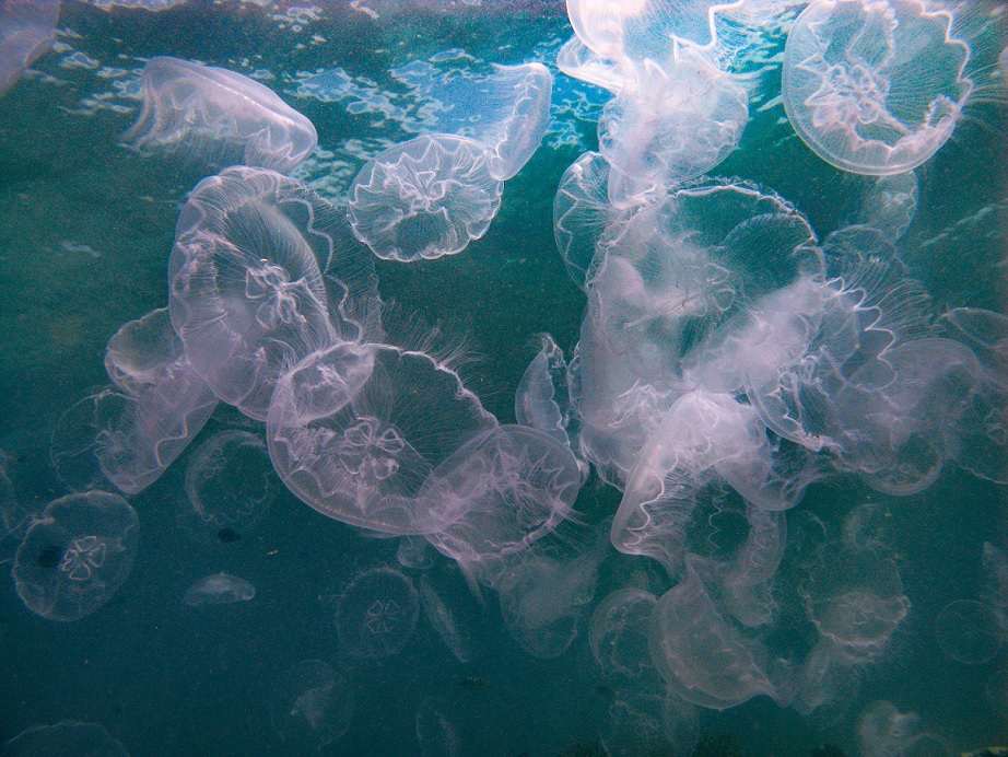
“There has also been an increase in the sighting and frequency of mass jellyfish blooms in Sabah’s waters, which could be an indicator of climate change,” she added.
DID Malaysia, with co-ordination from DID Sabah, has carried out three feasibility study projects by consultant for three areas namely Tinagat-Batu Puyong near Tawau, Tungku near Lahad Datu and Tanjong Aru-Kinarut coastal zone near Kota Kinabalu which are classified as Catergory 1 in Sabah.
DID Sabah is also working closely with other government departments/agencies involved in coastal zone management.
Meanwhile, Malaysian Association of Environmental Health Secretary Rudiaswady Abdul Rahim in January 2024 raised concerns over the ongoing coastal erosion affecting Malaysia, particularly in Sabah and Sarawak.
Overall, Malaysia’s 8,840km coastline faces significant challenges, with 1,347.6km affected by erosion and 431.3km classified as critical and significant.
Given that the data originates from 2015, Rudiaswady highlighted the urgent need for updated assessments. “We lack insights into the current state of coastal erosion.
But one thing is certain, it is deeply concerning that we may be losing our beautiful beaches,” he warned.
He urged the Government to conduct a comprehensive survey on coastal erosion and implement a holistic strategy incorporating nature-based solutions, hybrid strategies, early warning systems and investments in nature-based infrastructure to mitigate further damage.
Jellyfish blooms linked to climate change
CLIMATE change has altered the distribution patterns of sea turtles in Sabah, primarily due to rising sea temperatures, shifting ocean currents and habitat loss.
Dr Madihah said recent observations in Sabah suggest possible shifts in hawksbill turtle nesting sites.
“For many years, hawksbills have primarily nested on Pulau Gulisaan in Turtle Islands Park (Sulu Sea). However, a hawksbill turtle with flipper tags from Turtle Islands Park was recently recorded nesting in Semporna (Celebes Sea). This raises important questions about whether some turtles are beginning to explore alternative nesting beaches.
“This may be linked to habitat degradation, as severe erosion has impacted the main hawksbill nesting site in Turtle Islands Park, potentially forcing turtles to seek new nesting grounds,” she said.
On a global scale, she said shifting nesting sites have already been documented as a response to climate change. Warmer temperatures are pushing certain species, such as leatherbacks, further north, and some nesting seasons are expanding.
While extensive long-term monitoring is needed to confirm similar trends in Sabah, these local and global shifts highlight the need for conservation strategies to protect potential new nesting areas and enhance resilience against climate-driven habitat changes.
“There has also been an increase in the sighting and frequency of mass jellyfish blooms in Sabah’s waters, which could be an indicator of climate change,” she added.
 Dr Madihah also noted changes in the composition, abundance and size of fish species in commercial landings, as evidenced by the Annual Fisheries Statistics (published by Sabah Fisheries Department) and personal field observations since the late 1990s.
This ecological shift is known as “mesopredator release” where mesopredator populations increase due to the decline of apex predators, particularly large sharks and groupers.
However, she explained that shifts in the distribution of key marine species due to climate change are not yet particularly evident. The dominant coral species in Sabah, Acropora and Porites, continue to thrive despite environmental changes, demonstrating their resilience compared to other more vulnerable species.
Asked about the implications for local fisheries and communities dependent on these resources, Dr Madihah highlighted the impact of jellyfish blooms.
“Jellyfish feed on plankton, including commercial fish larvae, which can lead to a decline in certain fishery stocks. Additionally, jellyfish blooms can clog fishing gear, causing operational challenges for fishermen. Their increasing frequency also affects marine tourism, particularly activities such as snorkelling and diving,” she explained.
Despite these environmental changes, she emphasised that ongoing conservation efforts have led to an increase in Sabah’s sea turtle populations. As a result, their shifting distribution and climate-related changes do not yet have significant direct implications for local fisheries and communities.
Tropical storms now lash Sabah
TROPICAL Storm Greg devastated the State in 1996, affecting over 17,000 people and destroying nearly 5,000 houses. While the direct marine impacts were not well documented at the time, Dr Madihah said “heavy rainfall and flooding likely contributed to increased sedimentation and pollution in coastal waters, harming marine habitats.”
Similarly, Tropical Storm Hilda in 1999 caused widespread flooding and landslides, particularly along the West Coast. Like Tropical Storm Greg, the heavy rainfall would have increased runoff into coastal areas, potentially harming marine habitats.
“Rising sea levels and storms due to climate change is leading to more frequent and intense storms, which, combined with rising sea levels, exacerbate coastal erosion and threaten marine ecosystems in Sabah.”
Countering fish catch decline
SABAH’S fishing communities are facing increasing challenges as fish population declines due to climate change, habitat degradation and overfishing. Experts warn that commercial reef fish such as grouper and snapper are becoming scarcer, particularly in non-protected reef areas.
“Based on information we get from the local fishing community, commercial reef fishes like grouper and snapper are reducing,” said Dr Madihah.
The response has been to target ‘less favourable’ species.
“For example, species that used to be not fish for food are now available in the fish market. These communities are finding alternative livelihoods to adapt to declining seagrass health.”
The Fisheries Department is implementing management strategies, including regulating fishing activities. One such is using satellite assistance called iivms to track shoals.
More high biodiversity and ecological important areas would also be identified and gazetted as marine parks to regulated human activities and reduce impact to marine habitats and ecosystem services.
“The establishment of Marine Protected Areas (MPAs) Sabah also allow seagrass and other marine life to recover.”
Dr Madihah also noted changes in the composition, abundance and size of fish species in commercial landings, as evidenced by the Annual Fisheries Statistics (published by Sabah Fisheries Department) and personal field observations since the late 1990s.
This ecological shift is known as “mesopredator release” where mesopredator populations increase due to the decline of apex predators, particularly large sharks and groupers.
However, she explained that shifts in the distribution of key marine species due to climate change are not yet particularly evident. The dominant coral species in Sabah, Acropora and Porites, continue to thrive despite environmental changes, demonstrating their resilience compared to other more vulnerable species.
Asked about the implications for local fisheries and communities dependent on these resources, Dr Madihah highlighted the impact of jellyfish blooms.
“Jellyfish feed on plankton, including commercial fish larvae, which can lead to a decline in certain fishery stocks. Additionally, jellyfish blooms can clog fishing gear, causing operational challenges for fishermen. Their increasing frequency also affects marine tourism, particularly activities such as snorkelling and diving,” she explained.
Despite these environmental changes, she emphasised that ongoing conservation efforts have led to an increase in Sabah’s sea turtle populations. As a result, their shifting distribution and climate-related changes do not yet have significant direct implications for local fisheries and communities.
Tropical storms now lash Sabah
TROPICAL Storm Greg devastated the State in 1996, affecting over 17,000 people and destroying nearly 5,000 houses. While the direct marine impacts were not well documented at the time, Dr Madihah said “heavy rainfall and flooding likely contributed to increased sedimentation and pollution in coastal waters, harming marine habitats.”
Similarly, Tropical Storm Hilda in 1999 caused widespread flooding and landslides, particularly along the West Coast. Like Tropical Storm Greg, the heavy rainfall would have increased runoff into coastal areas, potentially harming marine habitats.
“Rising sea levels and storms due to climate change is leading to more frequent and intense storms, which, combined with rising sea levels, exacerbate coastal erosion and threaten marine ecosystems in Sabah.”
Countering fish catch decline
SABAH’S fishing communities are facing increasing challenges as fish population declines due to climate change, habitat degradation and overfishing. Experts warn that commercial reef fish such as grouper and snapper are becoming scarcer, particularly in non-protected reef areas.
“Based on information we get from the local fishing community, commercial reef fishes like grouper and snapper are reducing,” said Dr Madihah.
The response has been to target ‘less favourable’ species.
“For example, species that used to be not fish for food are now available in the fish market. These communities are finding alternative livelihoods to adapt to declining seagrass health.”
The Fisheries Department is implementing management strategies, including regulating fishing activities. One such is using satellite assistance called iivms to track shoals.
More high biodiversity and ecological important areas would also be identified and gazetted as marine parks to regulated human activities and reduce impact to marine habitats and ecosystem services.
“The establishment of Marine Protected Areas (MPAs) Sabah also allow seagrass and other marine life to recover.”